This weekend I ventured back across the state line to South Carolina and continued my exploration of the Palmetto Trail-specifically, the Middle Saluda Passage. My previous post was also about the Middle Saluda Passage heading east from Jones Gap State Park to Rainbow Falls and beyond. Today I was in the Caesar’s Head State Park portion of the Passage – heading west toward Raven Cliff Falls and continuing on to the suspension bridge and Gum Gap Trail.
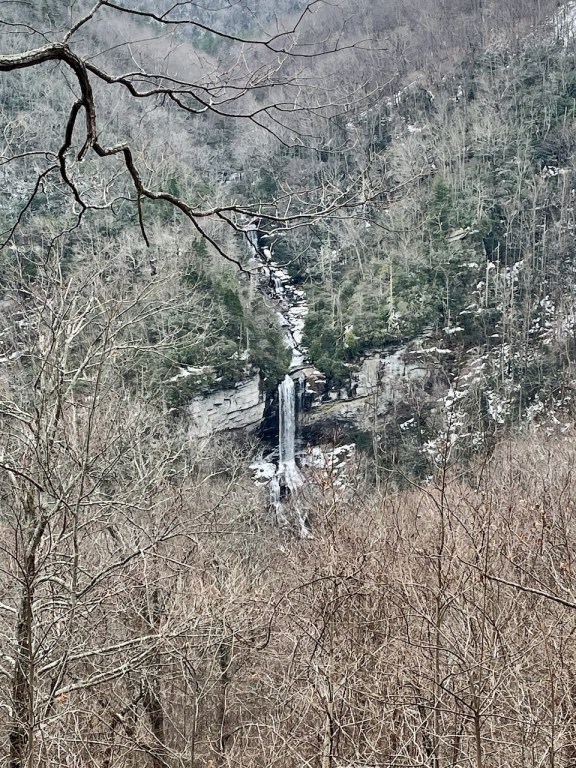
This was actually my second trip on the Raven Cliff Falls Trail. Three weeks earlier I hiked to the overlook of the falls, shown in the picture above. The falls drop over 400 feet and are impressive even from the distance of the overlook. The hike to the falls from the parking area is about 4.4 miles round trip.
Obviously, the weather between the two hikes was remarkably different. My first hike was just after some significant snowfall and several days below freezing. The trails had been well traveled and after several thaws and refreezing, much of the path was hard packed with snow and ice. It was also overcast, cold and bottom line. . . ‘I just wasn’t feelin’ it…’. I have had to convince myself, that it is not smart to push yourself to hike if something is telling you not to. So on that day, I went to the falls overlook and headed back to the car.

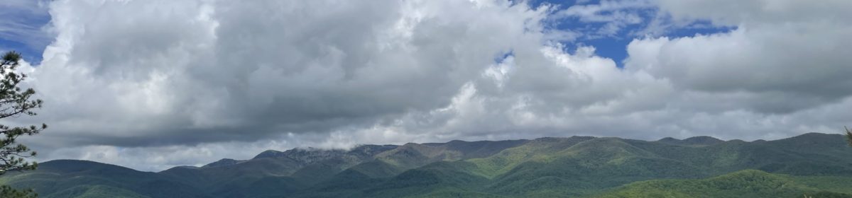
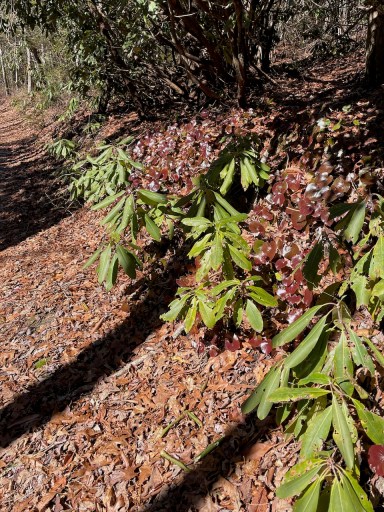
Obviously, this day was a much better day for hiking. Beautiful blue skies and temps in the 50’s. The hike begins from the Raven Cliff Falls Parking area in Caesar’s Head State Park (Hwy 276). Similar to my post, Middle Saluda Passage- Part One, there is a fee to park. These trails are part of the Middle Saluda Passage trail system; the Palmetto State Trail as well as the Foothills Spur Trail all within the Mountain Bridge Wilderness Area.

The above map can be downloaded from the Palmetto Trail Website. All of the trails in this area are well blazed (color coded) with trail indicators at all major trail intersections. The Middle Saluda Passage has excellent signage by way of kiosks, where each trail is numbered and color coded with distances. I recommend always taking a physical map with you on hikes, but it is also advantageous to take pictures of the kiosk maps as you are hiking through.
The Raven Cliff Falls Trail leaves the parking area and cross Hwy 276. After a short descent, it ascends again and skirts the side of the mountain. At this time of year there are excellent views to the south and east. The trail returns to the forest and the intersection for the Raven Cliff Falls Overlook is only about 2 miles from the parking area. From this intersection, the Gum Gap Trail leads to the right.
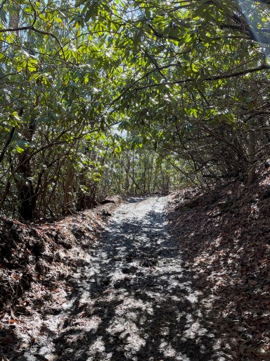
The Gum Gap Trail appears to be an old ‘cut-in’ road bed and is an easy trek without any major steep descents or ascents as it continues around the north end of Raven Gap Falls.
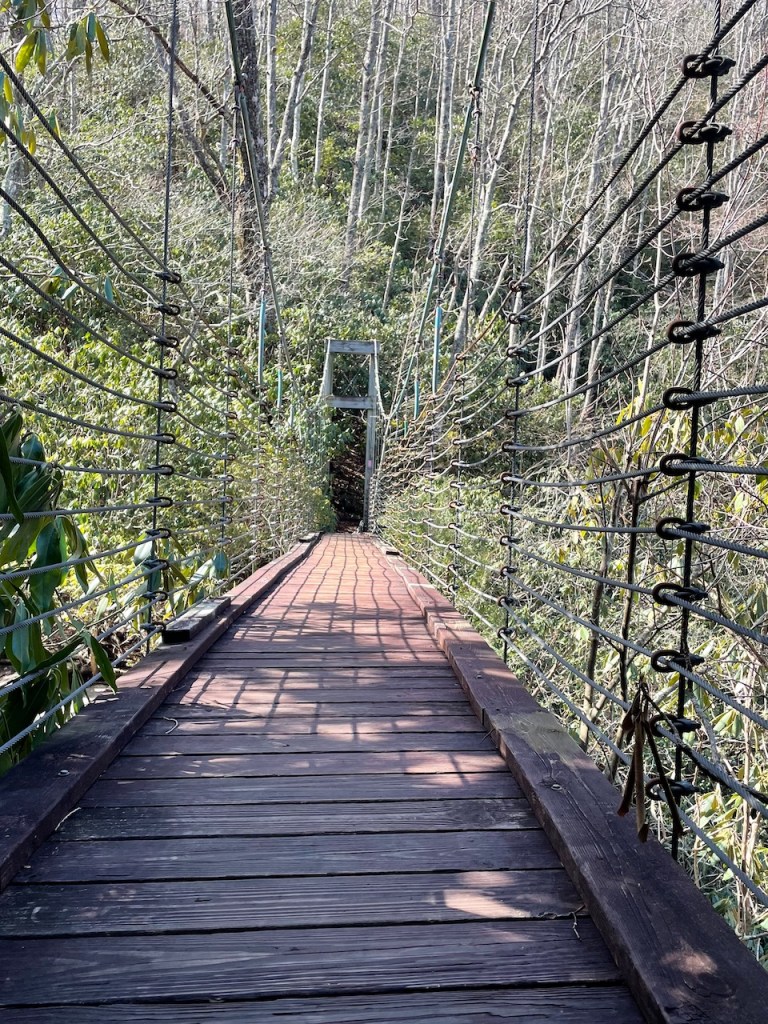
After about 1.2 miles on Gum Gap, the Naturaland Trust Trail (pink blazes) appears on the left with an information kiosk. Also, posted on a tree above the kiosk is a wooden carved sign “Suspension Bridge”. From this point, it is only about 1/2 mile down to the bridge with a steep descent of about 400 feet. Shortly after your turn on the Naturaland Trust Trail, you will hear Matthews Creek as it rushes down the mountain toward the falls.

Approaching the bridge, the trail parallels Matthew’s Creek and with our recent rains, the rushing water was crashing beyond the normal creek banks. There are a few outcroppings which make for excellent areas to relax and enjoy the relaxing sound of the water.
Experiencing the suspension bridge is well worth the trip. There was no one else on the trails and even though this is a popular hike, I felt like I had found a hidden gem. The bridge spans Matthews Creek, just where the falls begin their rapid descent. Needless to say, it is breathtaking to look over the edge. From the Ravens Cliff Trails parking area to the suspension bridge would be about 7.0 miles (round trip).
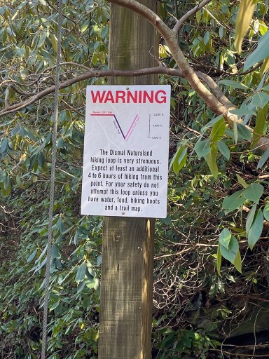
From this point, you have the option to continue south and east to loop around Raven Cliff Falls on the Naturaland and Dismal Trails. Ominous warning signs are clearly posted on each end of this loop. A brief look at a map shows how quick and steep the elevation changes (and returns).

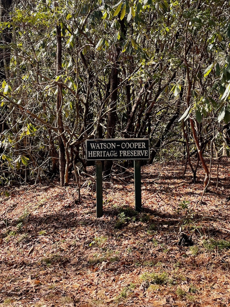
I opted to return back to the Gum Gap Trail and explore it to the western end of the Middle Saluda Passage. The trail continues west from the intersection with the Naturaland Trail for approximately 2 miles to the Gum Gap Parking area and goes through the Watson-Cooper Heritage Preserve. The Preserve includes over 1700 acres of protected land, which along with several other adjacent tracts make up the Mountain Bridge Wilderness Area. It follows along the South Carolina line and in fact, the Gum Gap Parking area is in North Carolina.
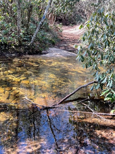
The Gum Gap Trail (which in this area is also the Foothills Spur Trail) crosses Matthews Creek. We had just had some major rain and with few rocks to jump across, so it became a wet crossing.
I was interested in hiking to the western end of the Middle Saluda Passage and in fact, the Gum Gap parking area extends past the points shown on the downloaded map above. From Raven Cliff Parking area it is about 5 miles one way. The Gum Gap Parking area is really hard to find on a map and it would take some researching to navigate to the area in a vehicle. From what I found on the internet, the road requires a 4-wd vehicle with good clearance.

On my return trip, I began to notice some activity in the many vernal ponds of water along the path. These temporary puddles were made from old tire ruts and erosion in the roadbed. I first noticed ripples and then bubbles as I would round a corner. On closer look, it was clear that these were Wood Frogs. They are the first in the region to breed and can be found when there is an early February temperature rise combined with rainy nights. I found dozens of puddles loaded with egg sacs. Let’s just say they put the love in Valentine’s Day!
The Middle Saluda Passage continues to amaze me with what it has to offer so close to home. I look forward to completing the eastern end soon.
40 Hike Challenge Blue Ridge Parkway Conserving Carolina Hickory Nut Gorge Hiking Lake Lure Linville Gorge Mountains to Sea Mount Mitchell North Carolina Trails
Very interesting, always look forward to reading and seeing the beautiful photos. Thank you for sharing these spots of Gods creation.
Very interesting!!! Loved the video!
Jack said the waterfall reminded him of a waterfall just off 321 in Caldwell county on Waterfalls Rd.