
Today’s forecast was for a slight ease in the temperatures, so I took the opportunity this morning to continue my MST hikes in Segment 2. My plan was to hike westbound from the Rough Butt Bald Overlook to Bear Pen Gap. My initial idea was to do an out-and-back for about 10 miles. However, one thing that I am stubbornly learning is that hiking requires flexibility and being willing to yield to your body’s limitations.

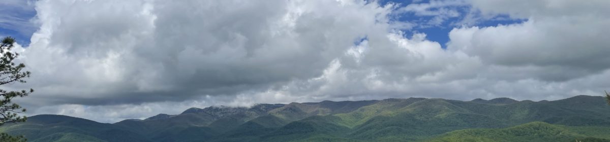
Due to work and other “life” requirements, it has been a few weeks since I have been out on the trail. As I hit the trail this morning, all of my senses were awakened and reminded me of what I have been missing. The forest was bathed in lushness that I cannot describe and pictures do not do justice. My first shock was of the quiet. The Blue Ridge Parkway had little traffic at this time and this section of Segment 2 was far from any other roadways.

Across the Parkway from the Rough Butt Bald Overlook is an MST spur trail. Typically, spur trails are marked with a blue circle instead of the typical white circle blaze. However, I did notice that on certain trails, the spur trails were just marked as white blazes. As always, it is good planning to always carry a map and be familiar with how to read it.

After about 0.1 miles on the spur trail, the MST intersection is obvious. To the right, the MST continues to the east and into the Middle Prong Wilderness Area. The trail is obvious and the first 2 miles is primarily pine, laurel and fern forest. The MST crosses the Blue Ridge Parkway at Haywood Gap. This is a possible connection point for other day hikes- note that the parking area is a small gravel lot with limited parking on the side of the Parkway.


After leaving the BRP at Haywood Gap, the trail ascends gradually about 400′ to an elevation of just under 5700′. The terrain also changes with a mix of wet and rocky paths to some open trail with a diverse display of wildflowers. The trail was lined with Coneflowers, Hoary Mint, Autumn Phlox, Joe-Pye weed, wood asters and many more.

At about 1.4 miles from Haywood Gap, a small side trail leads to the left (west) and breaks out into a surprising field or bald with an abundance of wildflowers, blueberries and blackberries. A thin path leads through the field to a small rock ledge that is a perfect spot for lunch. This area is obviously a popular spot for camping.
Update (8/8/2022): Per David Tate in the comments below, the clearing is called Wet Camp Gap. Also, there is a small, muddy depression in the center of the clearing which is named Bear Pond. Please read David’s comment below about all the people that worked to make the trail happen. Thank you!

Taking a break in solitude is a necessity. As I sat, enjoying my almond butter and honey wrap, I realized how crucial it is to sit in the silence of Creation. It is humbling, yet invigorating. Too many times I have rushed through hikes without enjoying the silence, peace and beauty all around me.
This was also a time for me to rethink my plan. Originally, I was going to hike another 1.5 miles to the Bear Pen Gap spur intersection, turn around and retrace my steps back to the car. My body was saying something different. I had already tumbled not once or twice but three times (I blame my broken shoe sole). I studied the map and realized that I could loop back on the Parkway and save myself about 3 miles – easy decision!

As can be seen in the image above, the MST intersection of the Bear Pen Gap spur trail can be a bit confusing. This is looking westbound and the actual MST is not very obvious as it goes down to the left (there is a marker sticking out of the wildflowers). Also, I did not see the spur trail when mapping on AllTrails. The spur trail is a gradual 0.6mile climb back up to the Parkway and Bear Pen Gap Overlook.

It was an easy 2.0 mile walk on the side of the BRP. The clear skies had yielded to fog and I could hear a thunderstorm rumbling in the distance. I made it back to the car just before the downpour began. The BRP was not crowded and the shoulders are easy to walk on without feeling like you are in danger.

Overall, it was good to be back on the MST. I would also recommend the bald and rocky outcropping for a day hike or picnic (accessed from either Bear Pen or Haywood Gap). Due to its location, it seems to be less crowded than some of the more popular sites along the BRP.
I am looking forward to completing the final 30 miles of Segment 2, hopefully this year.


40 Hike Challenge Blue Ridge Parkway Conserving Carolina Falls Lake Hickory Nut Gorge Hiking Jones Gap State Park Lake Lure Linville Gorge Mountains to Sea Mount Mitchell North Carolina Trails
As always, I really enjoy reading your blog. 😊
I hold that section of the MST deep in my memories. From 1981-1986, My wife and I spent many a day on that section helping with the Balsam Highlands Task Force in flagging and building the trail there. We helped with establishing the MST from highway 215 to the Bearpen Gap spur. Doris Hammett, Lynwood Macory J.D. Pittilo, Jim Loyd, Art Lowe, Melinda McWilliams, Jim Hallsey, and a cast of many, many others contributed to putting the trail on the ground there. It’s great that you enjoyed your hike on it. By the way, the grassy clearing is Wet Camp Gap, and the wet muddy area in the center of the clearing is Bear Pond.
David, many thanks to you and your colleagues for all the work. I know that is not easy but definitely rewarding. It is a beautiful trail. Also, thank you for sharing the name of the clearing. I also saw the depression and I wondered about it as well. I will update the blog post with that info.
Tom
Wish I were hiking at those elevations. Love the moss covered fallen tree trunks!