
If the hiking “bug” has hit you then one thing you have to learn quickly is to be flexible. Work and life schedules along with the weather have made it difficult for me to get out on the trail. With my goal to complete the Mountains to Sea Trail ever present on my mind, I have to admit that I have had a bit of tunnel vision lately. The sections I need to complete on the MST are getting further from home and that in itself has been a challenge along with arranging shuttles and working around a few stormy weekends. However, there is always a trail around, and hikers must hike.

So when I cannot reach the sections of the MST I have another challenge that I am working on – the Carolina Mountain Club’s (CMC) 100 Waterfall Challenge. If you are not familiar with them, the CMC has been in existence since 1923, and they love to lead hikes and take care of the trails. CMC leads over 175 hikes per year and maintain over 400 miles of trails including the AT and several sections of the MST. They also manage and help members log their hikes, as they have several hiking challenges available. One challenge that is popular is the 100 Waterfall Challenge. Some great resources are: 1. North Carolina Waterfalls, Third Edition by Kevin Adams and 2. (Map). Waterfalls of North Carolina. CMC also has a spreadsheet / log that can be found here. You will find that there is a wide variety of waterfalls to explore, all of which are reachable with different length and difficulties, but all accessible for day hikes.

My journey began at the Pisgah Forest Fish Hatchery and Center for Wildlife Education located just outside Brevard, NC off 276 and FR 475. The Waterfall Challenge does require some planning and homework in order to take advantage of waterfalls that may be in close proximity of a trail you are already hiking. I recommend that you also purchase an official Pisgah Ranger District map that shows all of the trails in the surrounding areas.
In this case, my plan was to hike up to John Rock in Pisgah National Forest. Along the way, I planned on visiting both Cedar Rock Falls and Grogan Creek Falls. The loop trail up to John Rock begins at the Fish Hatchery parking lot on the Cat Gap Loop Trail.

From the parking lot to the falls is just under a mile. At about 0.8 miles you will begin to hear the falls to your left, and you will see an obvious but unmarked trail to your left. It leads 0.1 miles down to the falls. The overall hike from the parking lot is an easy ascent of less than a few hundred feet in elevation.

To continue to Grogan Creek Falls, extend back up the spur trail to rejoin the Cat Gap Loop Trail. You will soon pass a campsite and another view of the falls from the top.

In less than 1/4 mile, the trail intersects with Butter Gap, leading to the right.

Grogan Creek falls is about 1 mile from the above intersection. It can be heard and is obvious from the trail. It is a short but extremely steep climb down to the base.

In order to continue up to the summit of John Rock, I needed to back track about 1 mile to Cat Gap Loop Trail. Along the way, I met this little guy. An Eastern Newt, actually a Red Eft, which is the juvenile stage of the newt. At this early stage they are more susceptible to predators, so their bright reddish-orange color is meant to trick would-be diners into thinking they are toxic.

The loop hike up to John Rock from the Fish Hatchery parking lot is listed at just under 6.0 miles round trip. This does not include the side excursion to Grogan Creek falls. It is a total of about 1000′ of elevation from the parking lot. The trail is well blazed and obvious. However, the final ascent to John Rock has a lot of washed out areas and exposed roots can be treacherous.

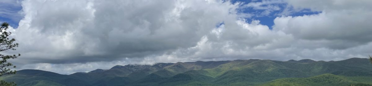
The summit of John Rock is around 3300′ in elevation. The best views can be somewhat hidden, depending on the time of the year. As you pass the actual summit, there are a few side trails to the left that will lead to the rock face and incredible views to the northwest of Looking Glass and the Blue Ridge Parkway beyond. As always, common sense safety measures should be taken here, especially with children.

The loop continues with an easy descent to the parking area. Along the way the trail passes along the Davidson River, and evidence is still present revealing the tremendous amount of damage that was done by Tropical Storm Fred in 2021.

This is actually the largest group of Lady Slippers I have ever witnessed. I have typically only seen these individually, scattered throughout the woods. When I was growing up in Western North Carolina, I had a sweet elderly neighbor that would pay us to bring back Lady Slippers and to transplant them in her flowerbeds. They obviously never survived. It was only recently that I learned that the Lady Slippers require and have a mutual survivor relationship with mycorrhizal fungi. The fungi help the root vascular system, while the Lady Slipper provides nutrients to the fungi. When these flowers are removed from their habitat, they will eventually die.
As always, let us all be stewards and leave the forest as we found it. All of these beautiful creations are available for us to experience – We just have to go out and discover!

40 Hike Challenge Blue Ridge Parkway Conserving Carolina Falls Lake Hickory Nut Gorge Hiking Jones Gap State Park Lake Lure Linville Gorge Mountains to Sea Mount Mitchell North Carolina Trails SC Trails
Thank you for sharing. As always you describe your experience so well and offer helpful tips. What a lovely hike!
Thank you for your comments and I am glad you find it beneficial.
Saw that bed of pink lady slippers on my hike there last year! I need to check out those beautiful waterfalls next time.
I lucked out with a few hours of sunshine in between storms. I enjoy seeing your journeys on FB.