Distance: 6.8 miles one-way
Difficulty: Strenuous
Elevation Change: gain = 1356 ft; loss = 2927 ft
My Hike: 6.8 Miles one-way (dropped car @ Cherry Cove Overlook)
source: Great Day Hikes of North Carolina’s Mountains-to-Sea Trail
I hiked this with my son, Noah and his friend. We tried to get out early on a Saturday morning, but a lot of other people had that same idea. The Black Balsam Knob hike provides outstanding views and very unique terrain.
With those features and it’s quick access from the Blue Ridge Parkway, it can tend to be a bit crowded (especially the parking areas) during weekends. Also, everyone seems to be ready to get outside and do anything after a year of Covid restrictions.
The MST trail starts right off of Black Balsam Knob Rd. It actually is on the Art Loeb trail for a few feet, and then you will see a quick MST trailblaze to the right.
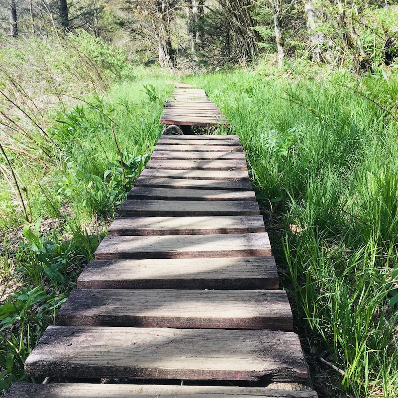
Some serious, time consuming trail work has been done in this area. There are approximately 13 bridges in less than 0.5 mile. These add a great feature to the trip.
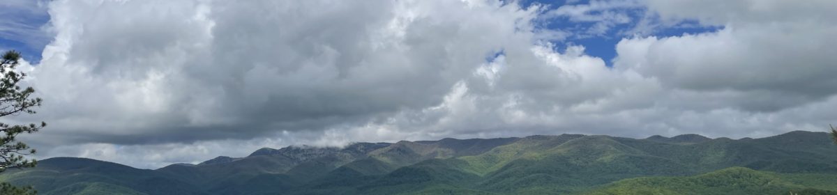
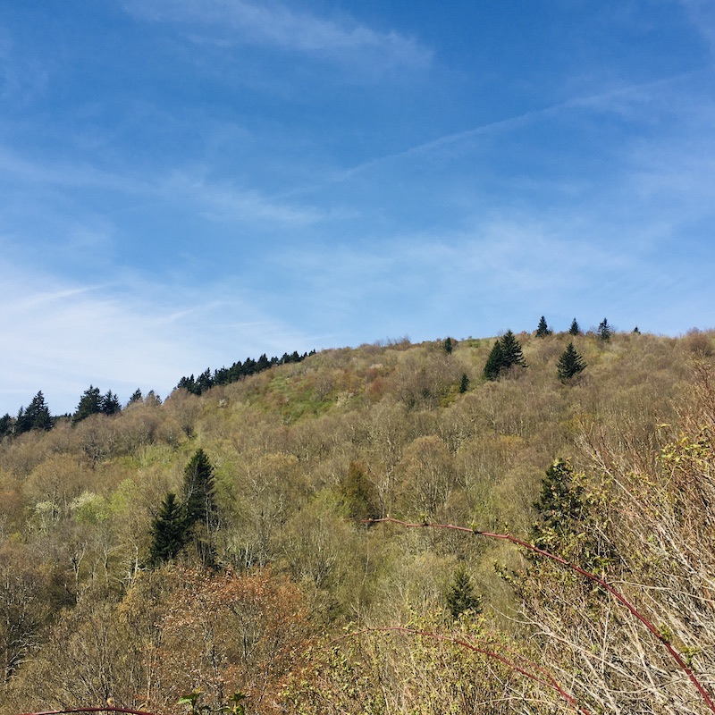
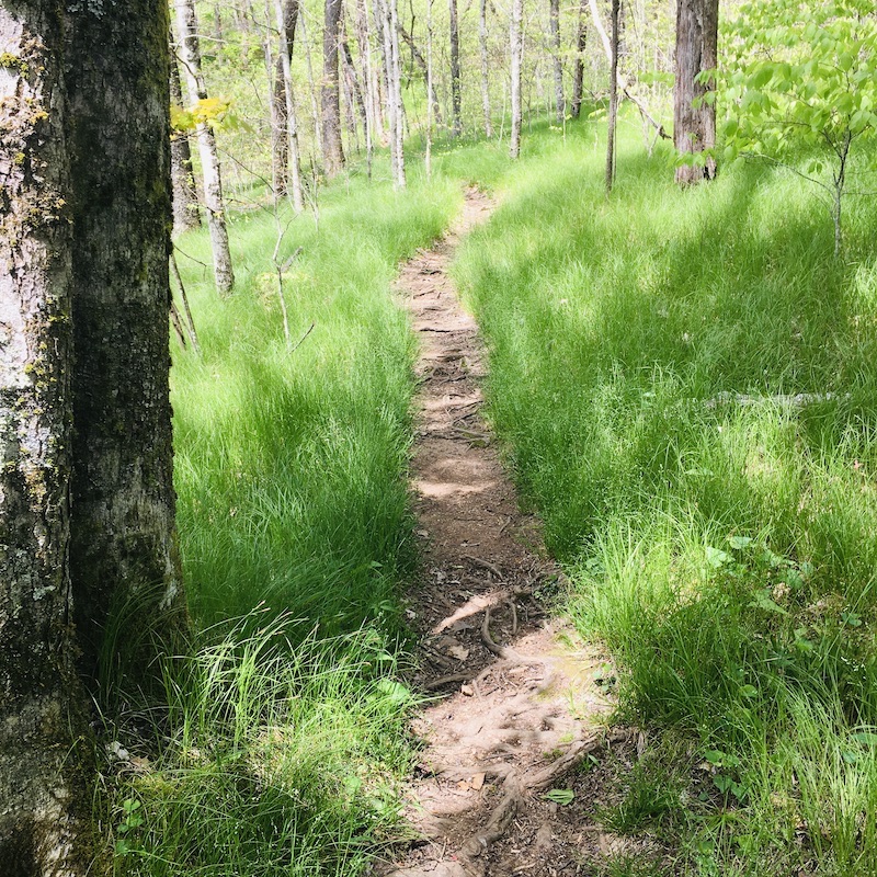
The majority of people in the parking area were typically hiking Black Balsam, Art Loeb, etc, so the first part of this hike was not crowded. In fact, during this time, the underbrush caused the trail to become a narrow single track. During the first few miles, looking up at the Black Balsam area was very impressive.
We traversed through a lot of grassy areas, on the east side of the ridge and occasionally would enter into some cool, refreshing tunnels of Mountain Laurel and Rhododendron.
Overall, the hike is a downhill trek and even though it contains a lot of rock, I would probably rate it more on the range of moderate-strenuous (it would definitely be strenuous if I was headed westbound).
There are a few junctions to be aware of, but they are well posted and the MST blazes are obvious. There is also the ability to connect with the Graveyard Fields area as well.
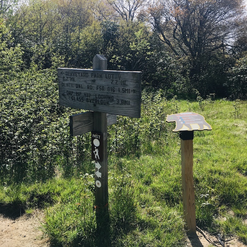
One warning: about 4.5 miles in, you will approach a stream (part of the Yellowstone Prong), the trail seems to go either right or left and at the time of this writing, I could not find any obvious trailblazes. I followed my Garmin GPS map and it told me to go right (with the stream on the left). This is the correct path. Upstream!
At about 5.0 miles from the Black Balsam Knob Rd., we reached Skinny Dip Falls. This is an extremely popular spot. It’s a great place to picnic and hang out (less than a mile from the BRP). It is also a wonderful place to swim, but it’s not for the faint of heart! I have taken the plunge here before and no matter what time of year, IT IS COLD!! The water is crystal clear and beautiful.
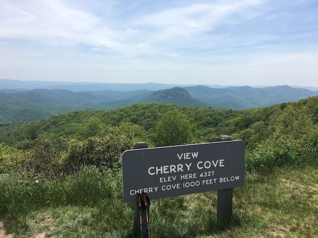
Our hike terminated at the Cherry Cove Overlook (MP 415.7). Overall it was a wonderful time to be together with my son Noah.
My recommendation for hikes in this area would be to try to hike it in mid-late fall when some of the leaves have fallen to take advantage of the views. Also, in mid-late fall, the falls area would probably not be as crowded.
so interesting, I like it