
It has been over a month since I completed the MST 40 Hike Challenge in January, so this weekend was a welcome homecoming to return hiking on the Mountains to Sea Trail. I lacked only about 7.5 miles to connect several sections of the trail that I had hiked last year-specifically, Pigeon Gap to the Pisgah Inn. This would give me a completed, continuous segment of 77 miles on the MST from the edge of the Middle Prong Wilderness to Walker Knob Overlook in Section 3. The trail did not disappoint!

Most of the trail in Sections 2 and 3 parallels or crosses close to the Blue Ridge Parkway. Pigeon Gap is near the junction of 276 and the Blue Ridge Parkway. At this time of the year, much of the Blue Ridge Parkway is closed. I had planned to hike this section in a loop by parking just off 276 and walking about 3.5 miles up the Parkway to the Pisgah Inn. There, I would then connect with the MST behind the lodge and then complete the 7.0 miles back to Pigeon Gap, hiking west.

I was surprised to find that on this early Friday morning, the Parkway gates were open. From what I could tell, not many people knew about this, so I continued with my plan. In just over 3 miles, I only met 4 vehicles. One thing I did not plan on was the short tunnel in this section. And by the way, it’s illegal to walk through a tunnel . . . when the Parkway is open.

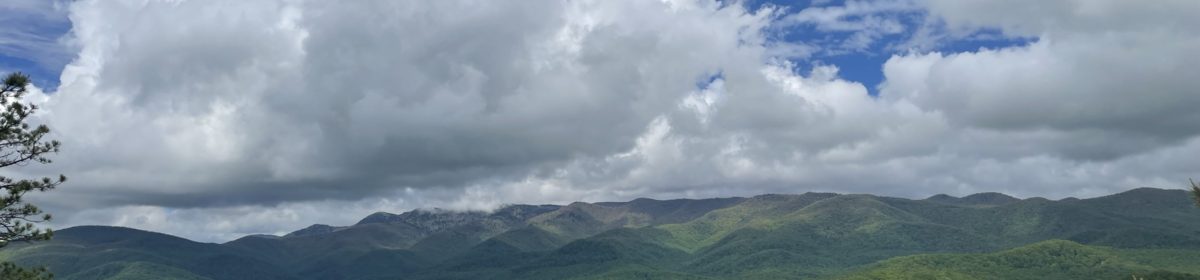
Walking on the Parkway with so few cars was a great experience with outstanding views throughout the trip up to Pisgah Inn. However, after just over 3 miles, I was pleased to finally be on actual trail. The MST passes just under the Inn (back side). It is wide and easy to find, even though I did not see any MST blazes, it was obvious this was the trail. The path soon switched to single track and began a series of switchbacks.
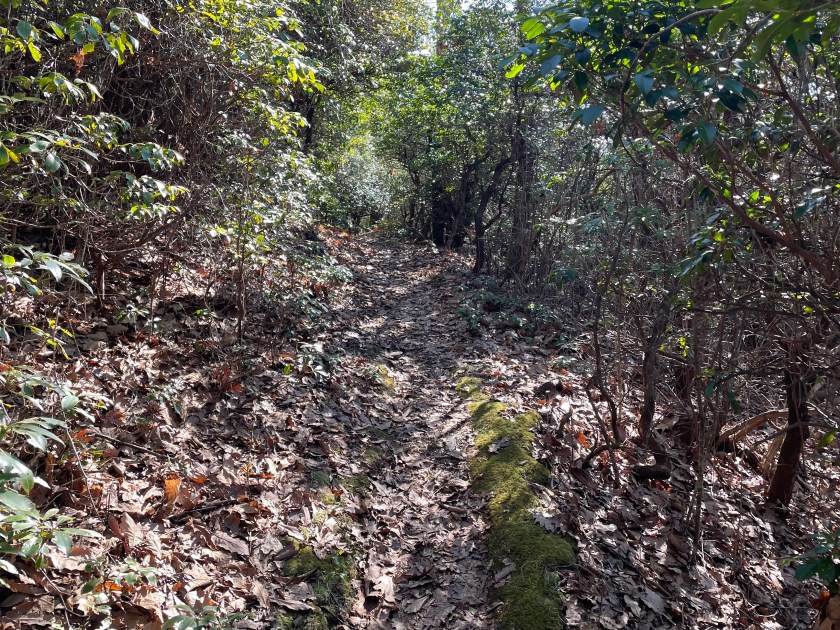

This is a sharp descent of about 800 feet in less than 2 miles. Thereafter, the trip along the trail has little change in elevation for the next 2.5 miles. The topography and flora changes back and forth during this trek from a dense forest area with lush Rhododendron and Mountain Laurel to drier areas with clear winter views and hardwoods.

There are plenty of water sources along this trail. In fact, the Carolina Mountain Club’s “Trail Profiles and Maps – Third Edition”, identifies 16 water crossings from Pisgah Inn to Buck Spring Trailhead. These are mountain creeks and not deep water, so they are skips or rock hops without any risk of getting wet. By the way, if you are planning on hiking any of the first 3 segments of the MST, I highly recommend the “Trail Profiles and Maps – Third Edition”. The maps and profiles/elevations are a great asset when planning a hike.

During this 7 mile hike, there is no access to the Parkway, however there are a few attractive camping sites and these are listed in the MST guides. The last couple miles is an ascent of about 600 feet back up to 276 and then to Pigeon Gap.
I was glad to take advantage of wonderful weather and to be back home – on the Mountains to Sea Trail. I look forward to continuing to ‘connect – the- dots’ as I attempt to complete all of the Trail. – Stay Tuned!


40 Hike Challenge Blue Ridge Parkway Conserving Carolina Hickory Nut Gorge Hiking Lake Lure Linville Gorge Mountains to Sea Mount Mitchell North Carolina Trails
I love reading your updates. I hope to segment hike the MST next year; mostly on weekends; Westbound 🙂
Megan, thank you for your encouraging comments. I am also limited to long weekends, but each hike has always been worth it. It will take me a few years, but the MST has so much to offer that taking my time is gratifying.