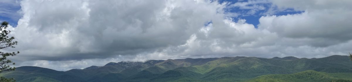

The Mountains to Sea Trail extends 1175 miles over roads and trails from Clingman’s Dome to Jockey’s Ridge. The MST is broken down into 18 segments, each providing the traveler with a different taste of our diverse state of North Carolina. Segment 17 is a unique experience as it treks through quaint coastal communities and ending with a walk through the Cedar Island National Wildlife Refuge. This segment offers a different element to the MST hiking experience since it consists of only road walking on part of the Outer Banks National Scenic Byway.
Source: Great Day Hikes of North Carolina’s Mountains – to – Sea Trail
Hike #36 “Down East” Williston to Davis
Distance: 3.9 miles one-way
Difficulty: Easy
The term “Down East” is not an arbitrary location- it actually refers to a specific region of the North Carolina coast which includes 13 communities located in Carteret County. By definition, Down East begins at the North River Bridge in eastern Carteret County and extends to Cedar Island. The nautical term “Down East” refers to wind direction and sailing. Residents in this area are proud of their name and do take exception to those that use it in a general sense to encompass areas for which it was never intended. For an interesting discussion, I urge you read about the controversy over the previous naming of the Kinston Minor League Baseball team. You can find the link here.
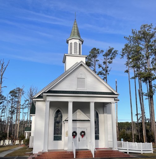
Hike 36 begins at Williston United Methodist Church and follows US 70 3.9 miles to Davis Shore Provisions. There is an information kiosk in the parking lot that contains some very interesting facts about the area and especially regarding the economic significance of the Willis Brothers Seafood company.

The road crosses over Williston Creek and continues through a small residential area. In most places, the road side has wide grassy areas to walk, however there were a few curves where I felt safer crossing briefly to the other side. This is not a busy highway, but there are enough cars and trucks that the hiker has to be extremely careful. I recommend that you wear as much blaze orange as possible. While most people were courteous, there was an occasional vehicle that made me question if they actually saw me. Do not assume they see you!
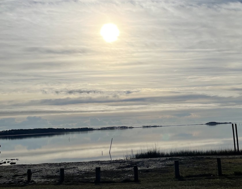
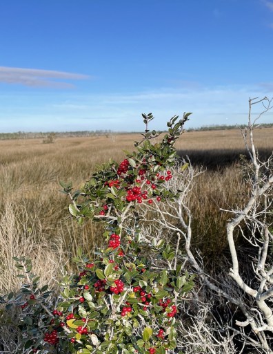
After leaving the Williston community, the road crosses through a salt marsh for several miles. With marsh and tidal wetlands on either side of the road, there is much to take in as you are walking.

There were large numbers of all types of waterfowl in the water and brush along the road. Their calls and screeching were a constant reminder that even though I was walking on a highway, I was actually in a wilderness area.
This challenge hike ended at a crossroads where there is a convenience store and Davis Shore Provisions across the road. Everyone I met in the area were very friendly and welcoming.
Hike #37 Cedar Island National Wildlife Refuge
Distance: 5.9 miles one-way
Difficulty: Easy

The Cedar Island National Wildlife Refuge located on the southern end of the Pamlico Sound consists of approximately 11,000 acres of brackish marsh and 3500 acres of woodland. The Refuge provides habitat and protection for many endangered species and migrating waterfowl as well as environmental and wildlife education for the public.

Hike 37 starts at the boat ramp on US 12 just west of the bridge over the “Thorofare”. The bridge gently slopes up and then down for about 1 mile as it crosses the water and continues through the refuge. From the top there are excellent 360 degree views.

Walking on the side of the road in the Cedar Island Refuge is actually a bit different than the previous Hike 36. For the entire 6 miles I saw less than 20 vehicles. I still recommend all my safety precautions that I listed in the previous hike for any road walking.

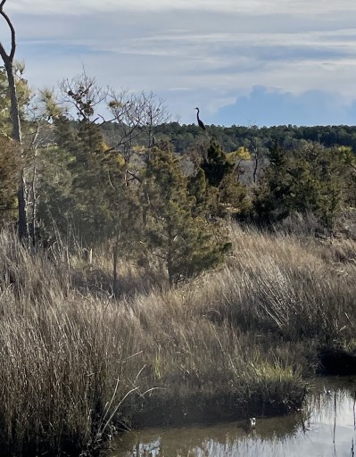
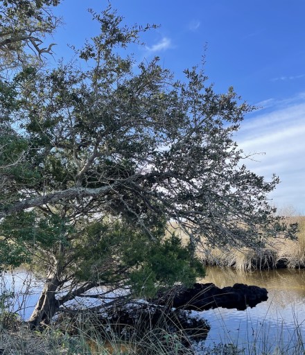
I was amazed at the amount of solitude I had on this hike. The views are breathtaking of the tidal marsh, water and grasses. Waterfowl abounded in this area as well. At about 5 miles into my trek, I turned around and could see the beginning of the bridge in the distance, where I had first begun.
I have to admit, when I was planning this day of about 10 miles of road walking, I was skeptical. I am accustomed to day hikes in the mountains, and I wasn’t sure what I was going to experience. Overall, I really enjoyed my time on these hikes and I am thankful to get to experience such a beautiful, wild region of our diverse State.
A complete list of the 40 Hikes and their Blog Posts can be found here
40 Hike Challenge Blue Ridge Parkway Conserving Carolina Falls Lake Hickory Nut Gorge Hiking Lake Lure Linville Gorge Mountains to Sea Mount Mitchell North Carolina Trails
Another great journey, so enjoy reading about each one. You are so blessed to be able to experience the beauty of our Father’s creation in this way. Look forward to the next one!
Thank you JoAnne. I agree! We are surrounded by His beauty.
This is not only interesting but educational, too.
Thank you Mary. I found hiking the MST a very educational experience. I really enjoyed learning about our great State of NC.
Thomas, love your photos and descriptions. It is a wonderful variety from most of the MST. When the ferry is packed in summer tourist season the walk is less enjoyable.
Thank you Jerry, I am glad you like the post. I agree that this time of year is probably a better time to hike the road. The temperature was very comfortable and no bugs! Also, I did notice that around the time of the ferry, some of the traffic would pick up.